AI GIS Technology System
From machine translation to audio, to image recognition, to unmanned driving, artificial intelligence (AI) technology is deeply affecting our work and life. Artificial intelligence is regarded as a major technological innovation in the same level as computer and Internet. It has become an important goal for IT enterprises and a new focus of international competition. On the road of AI and GIS integration, AI GIS technology system emerged.
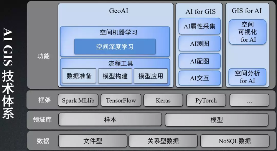
The system contains three core contents:
- GeoAI: fuses AI analysis and processing;
- AI for GIS: AI enables GIS, that is, based on AI technology, to enhance and optimize GIS software functions;
- GIS for AI: GIS empowers AI, that is, based on GIS technology, AI analysis results are further processed and analyzed and spatial visualization is presented.
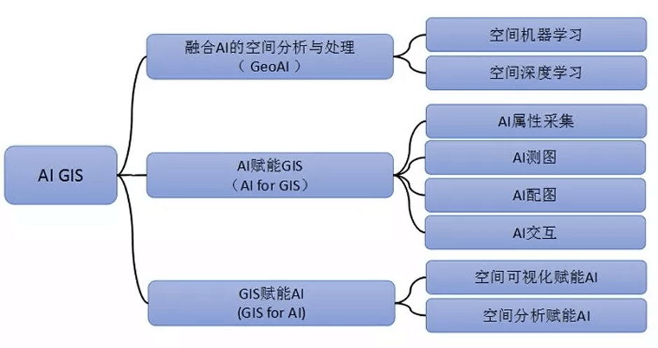
AI GIS trilogy
GeoAI
Based on the basic theories and algorithms of artificial intelligence, such as statistics, machine learning and indepth learning, system innovation has realized a series of artificial intelligence GIS functions for geographic space problems, serving GIS spatial data processing, analysis, mining and comprehensive modeling.
Space machine learning
Machine learning is the core of artificial intelligence research at present which allows “automatic learning”. Three typical problems in the field of machine learning include clustering, classification and regression. And research of space machine learning mainly focuses on these three basic problems.
The current space of machine learning operator offered include spatial hot spot analysis, spatial density clustering, classification and regression analysis based on forest, generalized linear regression analysis, to help resolve commercial hot spots detection , residential cluster analysis, plants and animals, natural disaster areas prone to speculation, urban housing regions forecast, etc, various natural and social problems. In order to support spatial big data computing, machine learning algorithms are effectively combined with distributed computing, which greatly improves the performance of spatial machine learning.
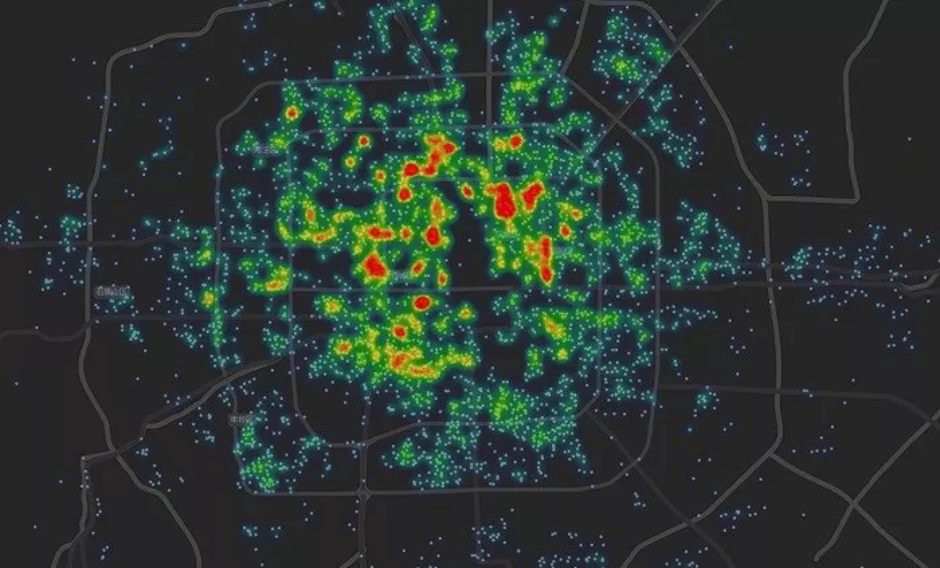
The return of property price variation
Spatial deep learning
Deep learning is a part of machine learning technology that allows computers to mimic the mechanics of the human brain. As deep learning technology has shown good application effect in computer vision and image understanding, it can improve the efficiency and accuracy of image processing when applied to remote sensing image analysis.
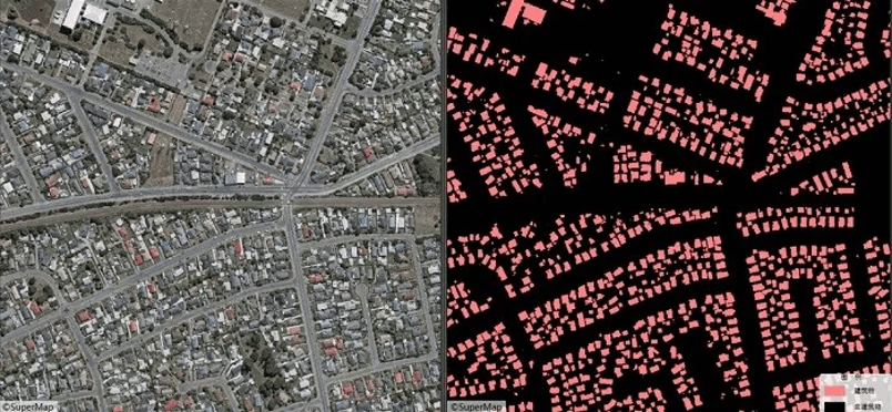
Image building extraction based on spatial deep learning
AI GIS process tools
Due to the diversity of geographic information applications, when the basic model cannot fully meet the needs of users, you can use the provided process tools to train your model.
The general application step of machine learning is to select a model – trains model – use a model. So the usage of corresponding GeoAI functionality needs a complete process from data preparation to model application, as shown in the following diagram. The components, desktop and server products of the system respectively provide artificial intelligence GIS workflow tools that support data preparation, model construction and model application, facilitating software users to train and use their own models based on their own data and application scenarios.
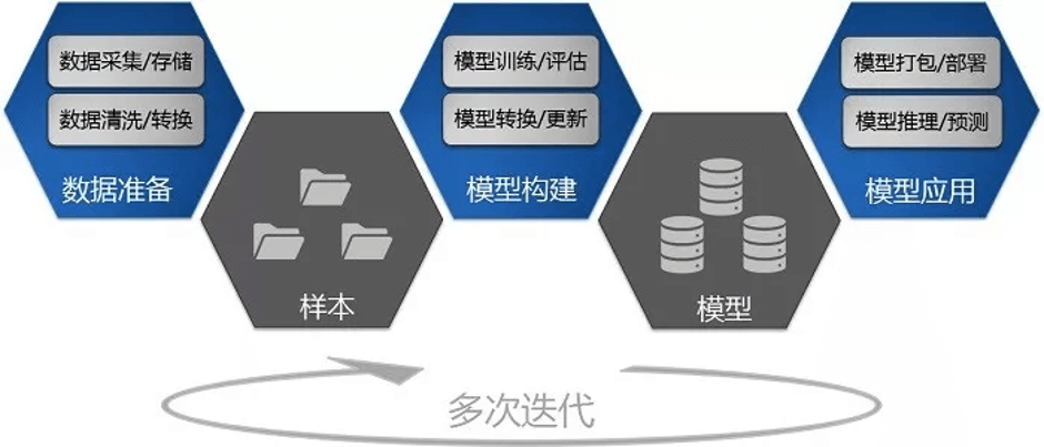
GeoAI Workflow
AI for GIS
AI for GIS refers to the enhancement and optimization of GIS software functions based on AI technology. For example, AI technology is applied to some traditional GIS services to realize the intelligent evolution of GIS software functions.
At present, the system mainly provides four functions: AI attribute acquisition, AI mapping, AI illustration and AI interaction.
The AI attribute collection function can help users to conduct multiple types of AI identifications like video images. For example, efficient collection of illegal parking, small ads, manhole covers and other data. AI mapping function provides lower cost and more convenient in-room mapping service. AI illustration function saves users from the tedious process of manual mapping. Through simple operation and style migration, relatively satisfactory map style can be obtained. AI interaction functions also include the use of voice control, empty gestures and other rich interactive ways to play GIS functions.
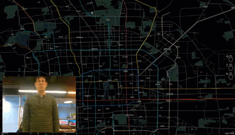
Air-off Gesture AI Manipulation GIS Desktop Products
GIS for AI
The evolution of Artificial intelligence also needs to constantly absorb and integrate other technologies. GIS can endow AI with more spatial visualization and spatial analysis capabilities and process AI analysis results in GIS software.
GIS can empower AI with spatial visualization, such as the application of map visualization of traffic flow monitoring, urban management components and cases, which can provide more intuitive information expression form for decision makers. GIS can also empower AI with spatial analysis, such as real-time warning for geographic fence, vehicle route tracking, etc., to provide greater value for users together with AI.
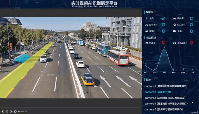
Geographic fence real-time warning
Source :SuperMap-GIS
熱門頭條新聞
- The gaming universe is in motion. And not in just one direction.
- EU Allocates €6.1 Million to Empower Game Studios for Innovative Tools & New Business Models
- Insight ’26: The Post-Production and VFX Business Conference
- gamescom 2026: Games spark excitement for the future
- SIGGRAPH 2026 Unites Global Computer Graphics Community in Los Angeles With Landmark Keynotes, Inaugural Games Summit, and AI Innovation
- Deck-Building Roguelike Adventure Talespinner Comes to PC & Switch This August
- Full Event Lineup Unveiled for PIS 2026, The 27th Preview in SEOUL Builds Integrated Global Textile Industry Platform
- Google to Open Google Play to Third-Party App Stores Starting Last Week ; Antitrust Ruling Reshapes Android Ecosystem with Short-Term Revenue Pressure on Google